
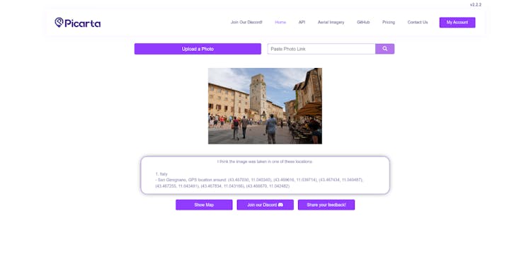
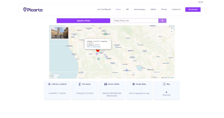
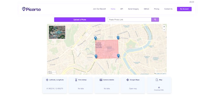
Picarta is a powerful AI tool that identifies where any photo was taken by analysing visual content. Just upload an image, and Picarta returns accurate GPS coordinates—no metadata needed. Whether it’s a travel snapshot, drone footage, or a social media post, Picarta helps reveal the exact image location worldwide.
Perfect for OSINT, investigations, journalism, real estate, historical research, travellers, photographers, and more, Picarta supports global geolocation for ground-level and aerial imagery.
Use Cases:
- Verifying image authenticity and location
- Supporting law enforcement and private investigations
- Travel planning and destination discovery
- Property photo verification in real estate
- News fact-checking and documentary research
- Environmental monitoring with drone imagery
- Academic and archival photo analysis
Features:
- Web app, API, and offline deployment
- Global image search with ranked GPS predictions
- Python SDK for seamless integration
- Free tier available with scalable plans
Keywords:
AI geolocation, photo GPS finder, image location search, OSINT photo tool, visual location intelligence, reverse geolocation


Comments, support and feedback
About this launch
Picarta was launched by Picarta in July 15th 2025.
- 2Upvotes
- 2122Impressions
- #10Week rank